


Download-Software etikettierte vorbei coeus engineering
|
Das populärste Programm: Quick Slide Show 2.00

mehr Info |
|
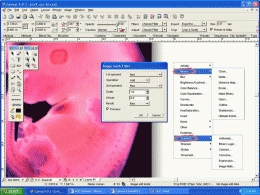
Wir empfehlen uns: Canvas Scientific Imaging Edition (Mac) 9.0.4
mehr Info |
HatchKit 2.5 durch Cadro Pty Ltd
2005-11-08
Draw patterns from scratch, open existing pattern files or import DXF or HPGL. Save to AutoCAD, LT, Revit, IntelliCAD, DataCAD, MegaCAD, MicroStation V8, TurboCAD, VersaCAD, SolidWorks and other formats ...
Canvas GIS Mapping Edition (Mac) 9.0.4 durch ACD Systems
2005-10-26
CANVAS 9 GIS Mapping Edition includes direct support for Geographic Information System data. You can take measurements in geographic coordinates, import SHAPE & GeoTIFF files into unlimited numbers of automatically aligned overlapping layers.
Canvas GIS Mapping Edition 9.0.4 durch ACD Systems
2005-10-26
CANVAS 9 GIS Mapping Edition includes direct support for Geographic Information System data. You can take measurements in geographic coordinates, import SHAPE & GeoTIFF files into unlimited numbers of automatically aligned overlapping layers.
Canvas Professional Edition (Mac) 9.0.4 durch ACD Systems
2005-10-26
CANVAS 9 is the high-performance drawing environment for professionals in business, science, and engineering. It seamlessly integrates technical drawing, image editing, page layout, web graphics & presentation features into a single application.
Canvas Professional Edition 9.0.4 durch ACD Systems
2005-10-26
CANVAS 9 is the high-performance drawing environment for professionals in business, science, and engineering. It seamlessly integrates technical drawing, image editing, page layout, web graphics & presentation features into a single application.
Canvas Scientific Imaging Edition 9.0.4 durch ACD Systems
2005-10-26
CANVAS 9 Scientific Imaging Edition blends native support for advanced imaging and DICOM support with Canvas' full range of vector illustration, image editing, page layout, web graphics, and desktop presentation features.
Canvas GIS Advanced (Mac) 9.0.4 durch ACD Systems
2005-10-26
CANVAS 9 Advanced GIS Mapping Edition: Direct support for Geographic Information System data. You can take measurements in geographic coordinates, import any popular GIS file types into unlimited numbers of automatically aligned overlapping layers.
Canvas GIS Advanced 9.0.4 durch ACD Systems
2005-10-26
CANVAS 9 Advanced GIS Mapping Edition includes direct support for Geographic Information System data. Take measurements in geographic coordinates, import any popular GIS file types into unlimited numbers of automatically aligned overlapping layers.
HiDigit 1.1 durch Binary Things
2005-10-26
HiDigit is a new calculating software with extended capabilities. It is recommended for use by math, physics and engineering students and teachers. The main advantage of the software is a simple input format even for the most complicated formulas.