


Download-Software etikettierte vorbei publishing
|
Das populärste Programm: Quick Slide Show 2.00

mehr Info |
|
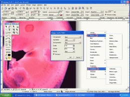
Wir empfehlen uns: Canvas Scientific Imaging Edition (Mac) 9.0.4
mehr Info |
Canvas GIS Mapping Edition (Mac) 9.0.4 durch ACD Systems
2005-10-26
CANVAS 9 GIS Mapping Edition includes direct support for Geographic Information System data. You can take measurements in geographic coordinates, import SHAPE & GeoTIFF files into unlimited numbers of automatically aligned overlapping layers.
Canvas GIS Mapping Edition 9.0.4 durch ACD Systems
2005-10-26
CANVAS 9 GIS Mapping Edition includes direct support for Geographic Information System data. You can take measurements in geographic coordinates, import SHAPE & GeoTIFF files into unlimited numbers of automatically aligned overlapping layers.
Canvas Professional Edition (Mac) 9.0.4 durch ACD Systems
2005-10-26
CANVAS 9 is the high-performance drawing environment for professionals in business, science, and engineering. It seamlessly integrates technical drawing, image editing, page layout, web graphics & presentation features into a single application.
Canvas Professional Edition 9.0.4 durch ACD Systems
2005-10-26
CANVAS 9 is the high-performance drawing environment for professionals in business, science, and engineering. It seamlessly integrates technical drawing, image editing, page layout, web graphics & presentation features into a single application.
Canvas Scientific Imaging Edition 9.0.4 durch ACD Systems
2005-10-26
CANVAS 9 Scientific Imaging Edition blends native support for advanced imaging and DICOM support with Canvas' full range of vector illustration, image editing, page layout, web graphics, and desktop presentation features.
Canvas GIS Advanced (Mac) 9.0.4 durch ACD Systems
2005-10-26
CANVAS 9 Advanced GIS Mapping Edition: Direct support for Geographic Information System data. You can take measurements in geographic coordinates, import any popular GIS file types into unlimited numbers of automatically aligned overlapping layers.
Canvas GIS Advanced 9.0.4 durch ACD Systems
2005-10-26
CANVAS 9 Advanced GIS Mapping Edition includes direct support for Geographic Information System data. Take measurements in geographic coordinates, import any popular GIS file types into unlimited numbers of automatically aligned overlapping layers.
Amiasoft SiteAid 2.30.223 durch Amiasoft Corporation
2005-10-26
Amiasoft SiteAid offers full HTML 4.0 Transitional support, feature rich Style Sheet support, an HTML validator, JavaScript tools, FTP support, colored syntax, spell check, advanced find/replace, full HTML and Style Sheet Help Files and much more.
A3D Stitcher 1.2 durch Anything3D Corp.
2009-07-07
Software for high quality panoramas creating. Intellectual stitching, full 360 and partial panoramas, multiformat import-export. Extended publishing to local storage, web and email (supported formats: static images, MOV, AVI, EXE, SWF).