


Download-Software etikettierte vorbei vehicle gps
|
Das populärste Programm: Quick Slide Show 2.00

mehr Info |
|
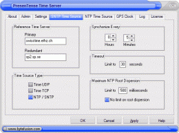
Wir empfehlen uns: PresenTense Time Server 4.0
mehr Info |
Track-Album 1.0 durch Track-Album
2007-11-22
Track-Album is a flight log for paragliding/hanggliding pilots, logbook for cyclists/skiers, it is also GPS software - allows you to download GPS tracks and view them in 3D in Google Earth
GPSMonitor 1.0.0.1 durch Infix Technologies
2008-03-29
GPSMonitor graphs the azimuth, elevation and signal strength of all visible satellites, and displays human-readable forms with information from several NMEA strings received from a USB GPS. The GPS uses an emulated serial port for communication.
VirtualGPS 1.37 durch KamLex
2009-02-01
VIRTUAL GPS - is a free software which works like real GPS (using information from cellular towers), but returns less accurate position. Accuracy of coordinates is about 200m in the urban area and up to 5km in the countryside.
Latitude Longitude 1.0 durch Latitude Longitude
2016-03-02
Latitude and Longitude app for android allows you to get or share map coordinates of your current location. share your current gps location with anyone using GPS coordinates, address or both.
Latitude and Longitude 1.0 durch Latitude
2016-03-10
Latitude and Longitude app for android allows you to get or share map coordinates of your current location. share your current gps location with anyone using GPS coordinates, address or both.
OziPhotoTool 2.6 durch OziPhotoTool
2005-10-26
OziPhotoTool takes the digital photos with EXIF metatdata, and tracks from OziExplorer to determine where the GPS was when the photo was taken. Check http://oziphototool.alistairdickie.com/download.html for smaller download options
TRANSDAT 10.03 durch Killet Softwareentwicklung GbR
2005-10-27
The program executes professional world wide coordinate transformations between international and national coordinate systems with or without transformation of the geodesic reference frame (datum change). Network ability. GPS interface.
RoboPhoto 3.1 durch RoboPhoto Software
2005-10-27
Publish thumbnail based web photo galleries. Includes GPS support, built-in FTP, EXIF, program automation, copyright stamper, an HTTP Soap client, XML image descriptions, batch processing, integrated e-mailer, and more. Very easy to use. F1 help.
CompeGPS LAND 6.1 durch CompeGPS TEAM S.L.
2005-12-24
CompeGPS is an essential software to make the most of your GPS. With this PC software you will be able to download a wide variety of cartography from the internet and also analyse your routes.